Postcard from CNS: Satellite Imagery and Identifying Weapons of Mass Destruction
Octave Lepinard ’19.5 described the highlights of his summer internship, from working for an expert on North Korean WMDs to locating uranium mines and doing interviews with the BBC.
This summer I was one of three Middlebury College students who was an undergraduate intern at the Center for Nonproliferation Studies (CNS) at the Middlebury Institute of International Studies in Monterey, Calif. This 10-week research program is led by Bill Potter, CNS’s founding director, and Masako Toki, CNS’s education project manager. The program is built to immerse roughly a dozen students in the world of nonproliferation through lectures and research projects.
A collection of lectures provided a broad overview of nonproliferation and the world of weapons of mass destruction (WMD), ranging from the details of the Iran nuclear deal to the physics of nuclear fission. Outside of the lectures, we were assigned to a CNS researcher working in a field similar to our area of interest, and we each helped our researcher with grants and projects. My supervisor was Melissa Hanham, an expert on North Korean WMDs and evaluation of new technologies’ potential, such as geospatial and satellite imagery analysis. On top of that, we had the opportunity to do independent research with the support of the top experts in that field. Independent research as well as research for a CNS expert can culminate in a publication or some sort of public display.
My case was somewhat unusual, as I study computer science and geology at Middlebury and therefore have very little experience with political science or other international relations issues. In recent years the program directors have worked to recruit and immerse STEM majors into internships at CNS. The lectures were fascinating, and the professors made efforts to include all the students.
I worked with Melissa and three other researchers at the Institute on multiple projects, helping them collect, process, and analyze satellite imagery. The first project was a website that crowdsourced analysis of satellite imagery to learn about potential areas of interest. Users selected a campaign that caught their attention and looked through the satellite imagery that we had selected. They could pin or label any object they found intriguing and leave a short description of what they thought it was. The goal was to harness the crowd’s random specializations to identify equipment, whose purpose we otherwise would not have known. I got to help design the user interface as well as pick and process the satellite imagery for the website.
I worked on another project where we tried to use satellite imagery and hyperspectral imagery to locate and distinguish uranium mines from other mineral mines. Hyperspectral imagery is captured by a camera or satellite that takes hundreds of images at one time—each for a specific wavelength of light. We then can attribute certain colors to bands in order to visualize it as a colored satellite image. We did this by talking with mining experts to isolate the buildings that were unique to uranium mining and teaching ourselves how to identify them in aerial images. Hyperspectral imagery covers a broad range of color wavelengths while maintaining spectral detail. This allowed us to analyze and compare spectral signatures between different objects in the imagery. We worked to develop a general hyperspectral signature for uranium mines that would help us distinguish a mine that may potentially be converted for this use in the future.
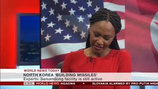
My summer research culminated in writing sections for two research papers that will be published in the fall, as well as getting a couple of the images I picked and processed circulated through the news. I even did interviews with both BBC World News (see below) and BBC World Service (radio) to talk about the possible construction of two intercontinental ballistic missiles and the suspicious activity that we spotted at a facility outside of Sanumdong.


