Students create virtual tour of Lake Champlain's underwater landscape

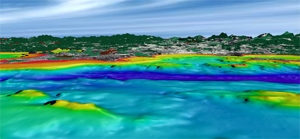
MIDDLEBURY, Vt. - The submerged landscape of Lake Champlain, sheltering shipwrecks and other mysteries, was for untold generations a shadowy world of scantly charted territory. From the surface, few people have been able to clearly understand what lies beneath - until now. With the help of a new database of more than 735,000 bathymetric measurements, Middlebury College students are creating a virtual tour to illuminate the depths of the 13,000-year-old lake for modern-day boaters, divers and landlubbers alike.
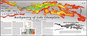
Working with Middlebury College Visiting Assistant Professor of Geology Tom Manley, senior Nate Vandal started the project during the college’s four-week winter term last January. The previous summer, Manley had completed an eight-year study called “The Whole Lake Survey,” working with his wife and colleague Middlebury College Professor of Geology Pat Manley and a team of researchers assembled with the help of Arthur B. Cohn, executive director of the Vergennes-based Lake Champlain Maritime Museum. The team utilized new side-scan sonar technology and the global positioning system (GPS) to create the most extensive bathymetric map ever made of the lake, which stretches 120 miles along the border between Vermont and New York. With the study’s results, Vandal began the laborious task of manipulating the bathymetric data into images that would make up the virtual tour.

The students’ high definition images will result in a three-dimensional, visual navigation that brings the viewer in from outer space, with Earth showing first as a tiny speck that grows to reveal oceans, land masses and finally Lake Champlain. The film tours the lake from above, at eye-level and ultimately into its waters and through its submerged landscape.

