Latest Findings From the Mars Curiosity Mission
- Sponsored by:
- Earth and Climate Sciences
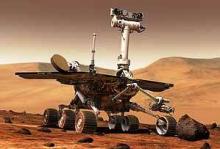
The Mars Curiosity rover is still going strong after 3.5 years on Mars and has recently reached exposures of sedimentary rocks that are yielding dramatic new insights into Martian history!
Please join us to welcome Chief Project Scientist John Grotzinger (Caltech/JPL) who will give an update on the latest findings and answer questions from the audience.
McCardell Bicentennial Hall 216
Open to the Public