| by Jessie Raymond

News Stories

Geospatial Excellence Award
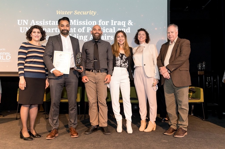
Allison Puccioni (second from right) and her team are all smiles after receiving their Geospatial World Excellence Award.
 

Allison Puccioni MAIPS ’08 and her UN team received the Geospatial World Excellence Award at the March 2022 Geospatial World Forum in Amsterdam for the Iraq Project, an environmental monitoring map for Iraqis to predict and plan around extreme heat and drought.

The award highlights how Puccioni has synthesized her two areas of expertise: geospatial analysis and international policy. When she came to the Institute in 2006, Puccioni already had an established career in geospatial analysis—a field she described as “essentially the science of using remote sensing data to better understand the earth.” She pursued a Master of Arts in International Policy Studies to help her apply her skills to issues surrounding international policy and security. 

She took what she called “a shot at the moon” for her professional service semester in January 2008, asking Ed Laurance, then a professor at the Institute, to connect her with the highly regarded Jane’s Intelligence Review, a military intelligence-adjacent publication. She landed an internship studying and writing about satellite imagery using open-source images, which, with the launch of the first commercial satellites, had only recently become available.

Puccioni wrote for Jane’s for about six years, where she earned “a smidgen of notoriety” for her pieces on everything from North Korean nuclear weapons to theft from oil refineries in Nigeria. She then moved on to stints at National Laboratory and Google, and in 2016 started her own consultancy, Armillary Services, which she still operates.

Armillary Services caught the attention of the United Nations Department of Political and Peacebuilding Affairs (UNDPPA). In 2018, Puccioni began teaching imagery analysis to UN political affairs officers. That work evolved into her current role at the UNDPPA, where she manages all of the mapping and geospatial work in the satellite remote sensing-related projects for the new Innovation Cell. 

“This is a small group of people who are chartered to work with emerging technologies and how they might apply to the UN mission at large,” she explained.

The Iraq Project

Daanish Masood, a UN colleague who had been stationed in Iraq, had an idea to use satellite data to map and predict water shortages in Iraq. He wanted to take information from satellites that had been measuring open-source environmental data over about 20 years—such as rainfall, surface water, elevation, population, even regional conflict—and synthesize it. This idea became the Iraq Project, and its geospatial team, of which Puccioni was a part, “connected all the data together. They interpolated it so that you can, every month in every tiny district in Iraq, have it on the map. It’ll turn red if things are really, really bad, and green if things are really abundant, and it will stay clear if things are the same.” 

By 2021, the team was “guns blazing” on the project. “We were getting a lot of traction from the UN Assistance Mission in Iraq, and we were getting a lot of amazing feedback from our colleagues in Iraq who really wanted to serve water security issues in their region of interest,” Puccioni said.

“We compare month-over-month, we account for season, and the upshot and the end product is a really interesting map that’s complex enough for people to really understand trends and forecasts. But it’s simple enough for people like farmers or local land managers to say, ‘This month is going to be really bad for this region.’” 

In order for people to take advantage of the map, however, they had to know that it existed. So, once it was fully functional, the team decided “on a lark” to enter the project in a couple of categories for the Geospatial World Excellence Awards. In Puccioni’s field, these are a big deal—“like the Oscars for geeks and nerds,” she said. They took home the award in the water security category.

“I’m damn proud of it,” Puccioni said.

While winning the award was a huge honor in itself, for Puccioni it felt even bigger because several team members, including Puccioni herself, had suffered serious health crises during their work on the project. “So much had gone into this that when we finally stood on that stage in Amsterdam, I was like, ‘I’m here. I’m never gonna leave.’ We were so thrilled about it.”

Recognizing that certain countries tend to go into famine immediately after both droughts and floods, the group is now adapting the Iraq Project to the entire Middle East and Central Africa. They’re expanding the focus on water severity to look at how climate change affects crop growth and whether there are better cultivars of crops—rice, corn, maize—that might be more appropriate in this era of climate change. The project will build on itself, Puccioni explained: “We’re taking the stuff we’re learning from the other countries and plugging it back into Iraq.”

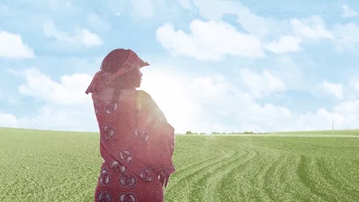
For the awards, the team hired a Middle Eastern company to create a short animation to introduce the Iraq Project and explain its potential uses.

The Iraq Project (UNDPPA)

Meaningful Accomplishments

Though it has taken time, Puccioni has reached a level of success she hadn’t foreseen. “Nobody is as surprised as I am,” she said, noting that she graduated from high school with a GPA of 1.8 and enlisted in the Army because she couldn’t immediately get into college. After working for years and following what she jokingly called “the 25-year education plan,” she has established a thriving business, taken on an important role with the UN, and now won an international award in her field.

The best part is being able to work with strong, caring people who are trying so hard to do something that’s going to help people.
— Allison Puccioni MAIPS ’08

For More Information

Geospatial World Forum